
![]()
![]()
![]()
To refer to some of the maps, places, and documents discussed in the episode, click on the images below to open the gallery and view them full-size.


Welcome to the third episode of the Global History Podcast. Today we’d like to extend a warm welcome to Barbara E. Mundy, Professor of Art History at Fordham University.
Professor Mundy teaches on art history in Latin America, with a particular interest in indigenous sixteenth-century art and cartography. Her publications include The Mapping of New Spain: Indigenous Cartography and the Maps of the Relaciones Geográficas, The Death of Aztec Tenochtitlan, the Life of Mexico City, and the co-edited volume Painting a Map of Sixteenth-Century Mexico City: Land, Writing and Native Rule. She is also the co-creator of the digital art history project, Vistas: Visual Culture in Spanish America, 1520-1820, co-authored with Dana Leibsohn.
On this episode, we’ll be diving into the complex world of colonial Mexico. So, what are the maps of the relaciones geográficas of New Spain, and why are they so fascinating? Why is it essential to study indigenous sources for the post-conquest world of Mexico, rather than just European ones? And why are images so important in our investigation of the past? Listen on to find out more.
If you have any thoughts, questions, or comments about this episode, or would like to pitch us an idea for a new episode, feel free to email us at theglobalhistorypodcast@gmail.com, or send us a message on our website’s contact form, facebook, twitter, or instagram.
IMAGE 1 and COVER PHOTO: Map of Tenochtitlán from the first Latin edition of the Second Letter of Hernán Cortés to Emperor Charles V, 1524. The Newberry Library, Chicago. Image downloaded from the World Digital Library.
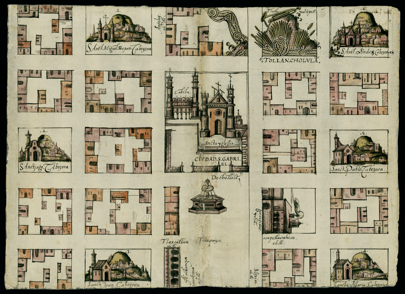
IMAGE 2: Map of Cholula, Mexico, 1581. Relaciones Geográficas of Mexico and Guatemala, 1577-1585, Joaquín García Icazbalceta Manuscript Collection, Benson Latin American Collection, University of Texas at Austin. 31 x 44 cm. Image downloaded from the World Digital Library.
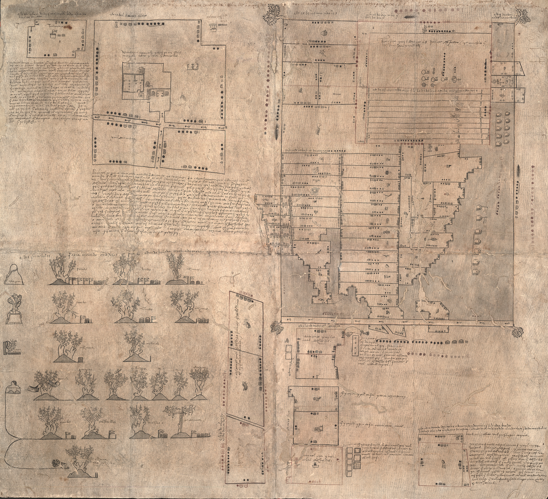
IMAGE 3: The Oztoticpac Lands Map, c. 1540. Library of Congress, Washington, D.C. 76 x 84 cm. Image downloaded from the World Digital Library.
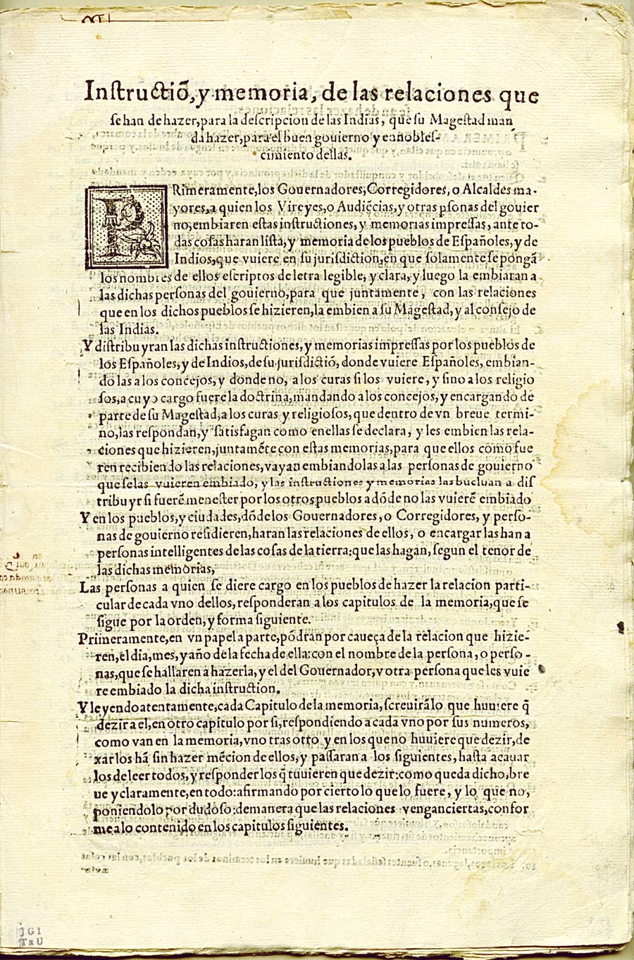
IMAGE 4: First Page of the Relaciones Geográficas questionaire, 1577. Relaciones Geográficas of Mexico and Guatemala, 1577-1585, Joaquín García Icazbalceta Manuscript Collection, Benson Latin American Collection, University of Texas at Austin. Image downloaded from the University of Texas at Austin here.
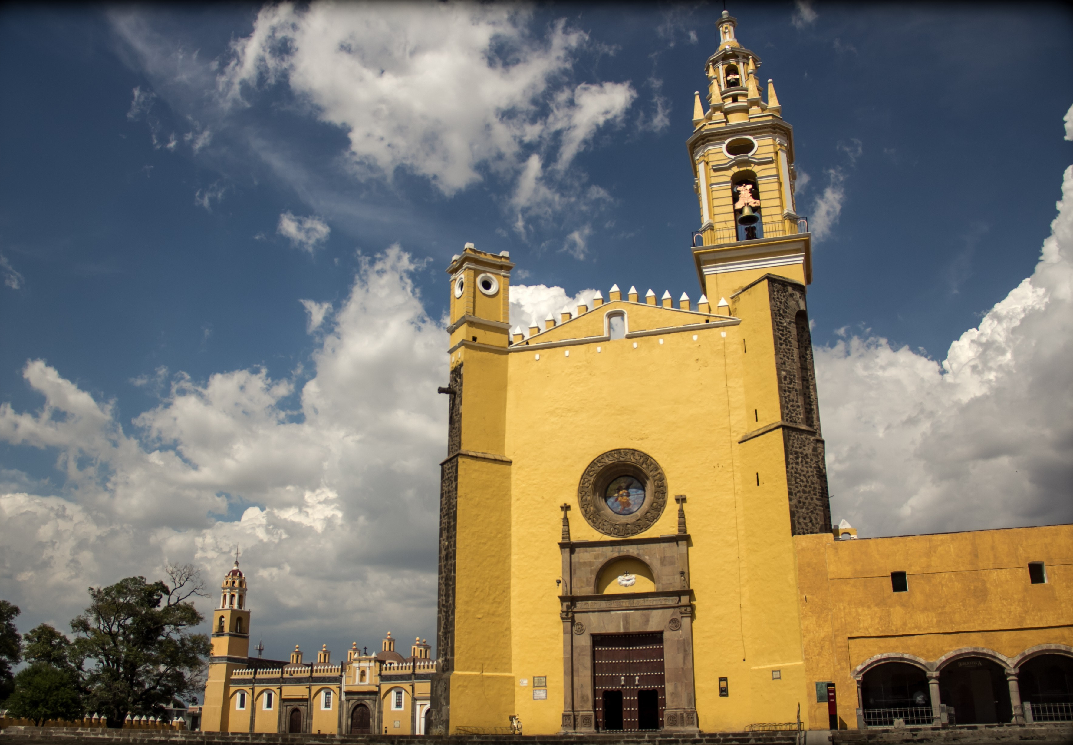
IMAGE 5: Facade of San Gabriel de Cholula, Mexico. Photograph taken by Alexandro G. Alonso S. on June 27, 2013. Image downloaded from Wikimedia Commons.
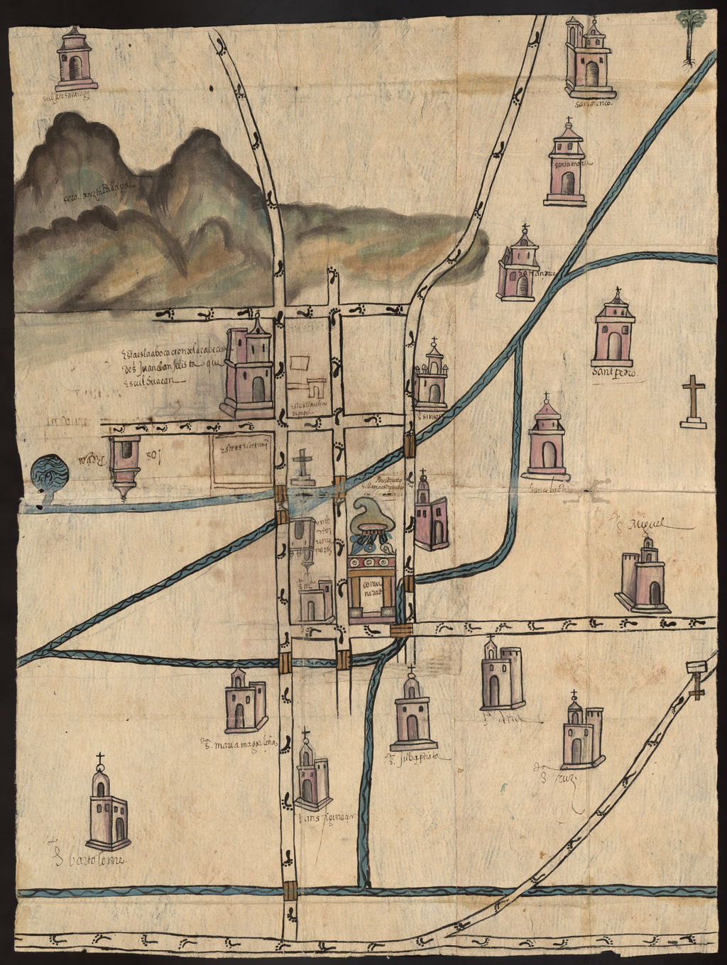
IMAGE 6: Map of Culhuacán, Mexico, January 17, 1580. Relaciones Geográficas of Mexico and Guatemala, 1577-1585, Joaquín García Icazbalceta Manuscript Collection, Benson Latin American Collection, University of Texas at Austin. 70 x 54 cm. Image downloaded from the World Digital Library.
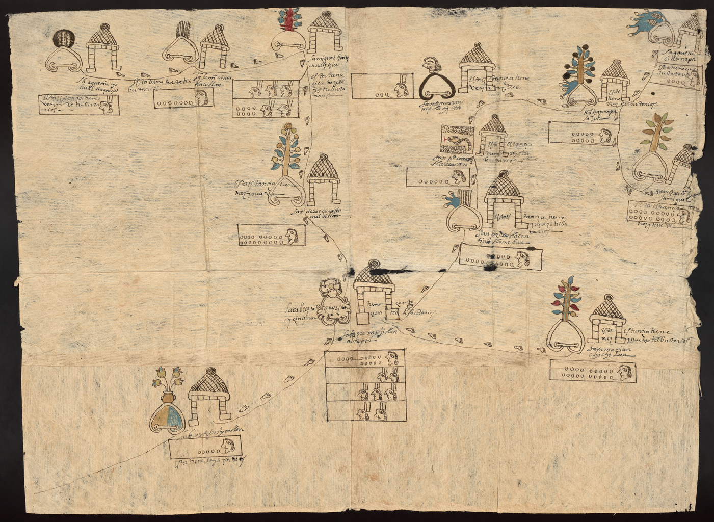
IMAGE 7: Map of Cempoala, Mexico, November 1, 1580. Relaciones Geográficas of Mexico and Guatemala, 1577-1585, Joaquín García Icazbalceta Manuscript Collection, Benson Latin American Collection, University of Texas at Austin. 83 x 66 cm. Image downloaded from the World Digital Library.
IMAGE 8: Map of Muchitlan, Mexico, March 7, 1582. Relaciones Geográficas of Mexico and Guatemala, 1577-1585, Joaquín García Icazbalceta Manuscript Collection, Benson Latin American Collection, University of Texas at Austin. 56.5 x 76 cm. Image downloaded from the World Digital Library.

Reblogged this on gutzko.
LikeLiked by 1 person