exploring cross-cultural encounters in the early modern world
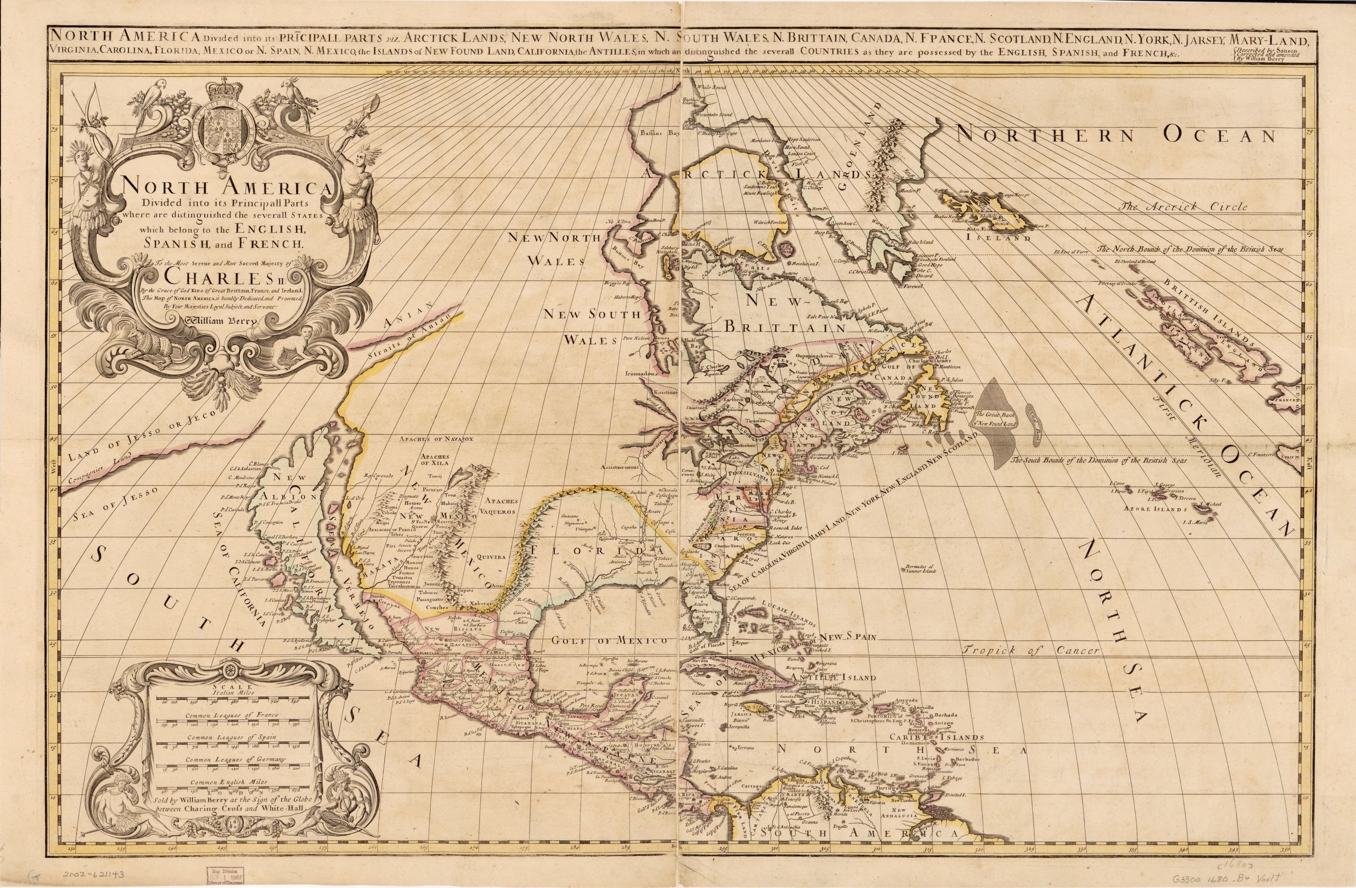
IMAGE 28: Entangled empires. ‘North America divided into its pricipall parts, viz. Arctick lands, New North Wales, N. South Wales, N. Brittain, Canada, N. France, N. Scotland, N. England, N. York, N. Jarsey, Mary-Land, Virginia, Carolina, Florida, Mexico, the islands of New Found Land, California, the Antilles, in which are distinguished the severall countries as they are possessed by the English, Spanish, and French, &c.’ (London: Sold by William Berry at the sign of the globe between Charing Cross and White-Hall, 1680). Description: “Relief shown pictorially. At upper right: Described by Sanson, corrected and amended by William Berry. Prime meridian: Ferro. Includes ill. Sectioned and mounted on cloth backing.” Medium: 1 map : hand col. ; 53 x 86 cm. Call Number/Physical Location: G3300 1680 .B4. Library of Congress Control Number: 2002621143. Library of Congress Geography and Map Division, Washington, D.C.