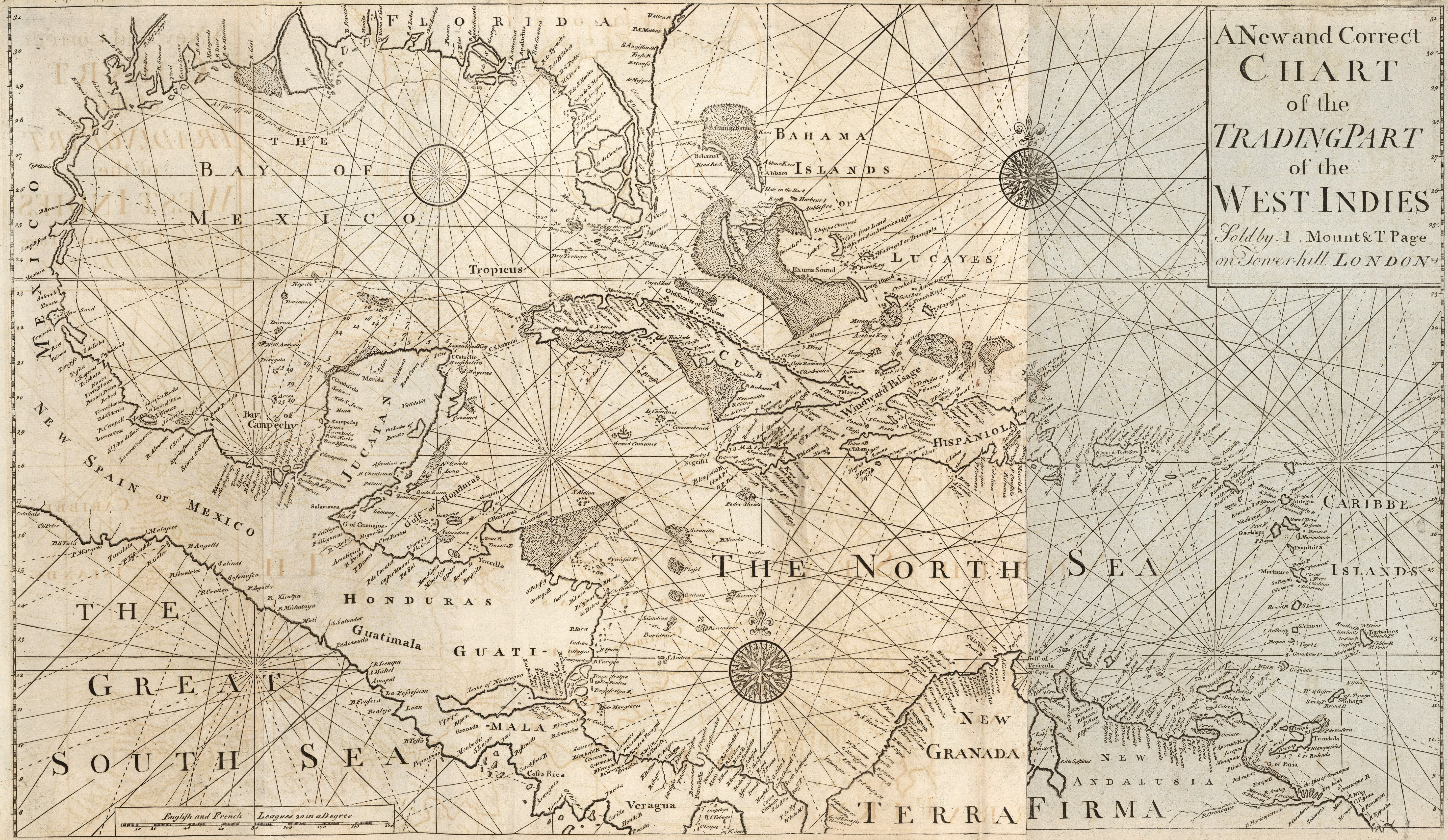
July 28, 2020August 2, 2020 IMAGE 3: How can scholars use cartography to write global maritime histories? Describing the West-India Navigation, from Hudson’s Bay to the River Amazones… (London: Mount and Davidson, 1794), Book 4, 1794 edition. Dimensions: Object Height: 48 cm; Object Width: 81 cm. Scale: 1: 5,700,000. List Number: 12434.067. Pub List Number: 12434.000. Image Number: 12434067.jp2. David Rumsey Historical Map Collection. © 2000 by Cartography Associates. Attribution-NonCommercial-ShareAlike 3.0 Unported (CC BY-NC-SA 3.0).