exploring cross-cultural encounters in the early modern world
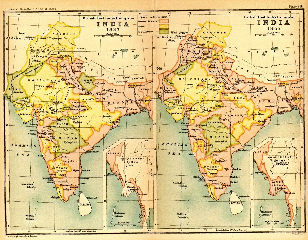
IMAGE 12: An Expanding Territorial Empire. Edinburgh Geographical Institute, ‘Map of India under the British East India Company, comparing 1837 with 1857’ (1907), in J.G. Bartholomew, Imperial Gazetteer of India (New edition, published under the authority of His Majesty’s Secretary of State for India in Council. Oxford: Clarendon Press, 1907-1909). Downloaded via Wikimedia Commons.