
![]()
![]()
![]()
Click on the images below to open the gallery and view them full-size. Thank you to Professor Cagle for providing and/or recommending several of the images below.


Welcome to the ninth episode of the Global History Podcast, which is also the next installment in our series on ‘Global Histories of Health, Medicine, and Disease in the Early Modern World‘.
On this segment, we’d like to welcome Hugh Cagle, an Associate Professor of History and the Director of International Studies at the College of Humanities at the University of Utah. Professor Cagle’s research focuses thematically on comparative colonialism and on science and technology studies, and geographically on Latin America, especially Brazil, as well as the broader Portuguese World. He is the author of Assembling the Tropics: Science and Medicine in Portugal’s Empire, 1450-1700 (Cambridge University Press, 2018), which won the 2019 Leo Gershoy Award from the American Historical Association.
About a week and a half ago, Chase spoke with Professor Cagle over skype about his research on the creation of the idea of the ‘tropics’, focusing on knowledge about nature, medicine, and disease in the Portuguese empire during the late medieval and early modern periods. Listen on to find out more.
If you have any thoughts, questions, or comments about this episode, or would like to pitch us an idea for a new episode, feel free to email us at theglobalhistorypodcast@gmail.com, or send us a message on our website’s contact form, facebook, twitter, or instagram. And if you’d like to listen to more segments in this series on ‘Global Histories of Health, Medicine, and Disease in the Early Modern World’, click here or listen to the playlist on Spotify.
IMAGE 1: Carta universal de Juan de la Cosa, 1500. Place of publication: El Puerto de Santa María, Cádiz. Material: parchment. Scale: ca. 1:1.900.000. Dimensions: Height: 96 cm (37.7 in), Width: 183 cm (72 in). Museo Naval de Madrid — Signatura: MNM-257. Downloaded from Wikimedia Commons. Public Domain. See the Biblioteca Virtual del Ministerio de Defensa for detailed information on the map, in Spanish.
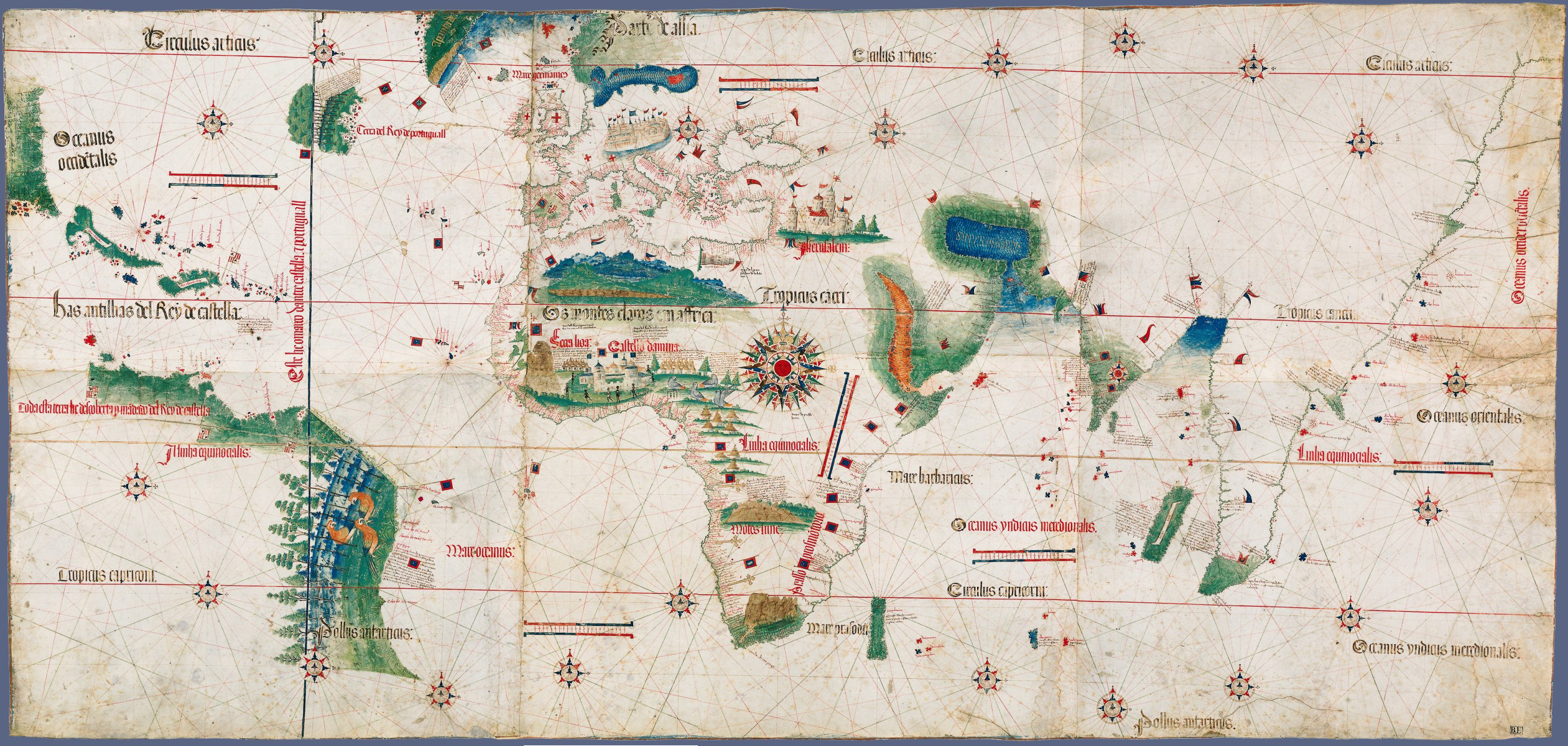
IMAGE 2 and COVER IMAGE: Cantino Planisphere (Carta del Cantino), ca. 1502. Biblioteca Estense Universitaria, Modena, Italy. Material: parchment. Dimensions: 220 cm x 105 cm. Downloaded from Wikimedia Commons. Creative Commons Attribution-NonCommercial-NoDerivs 3.0 Italy License.
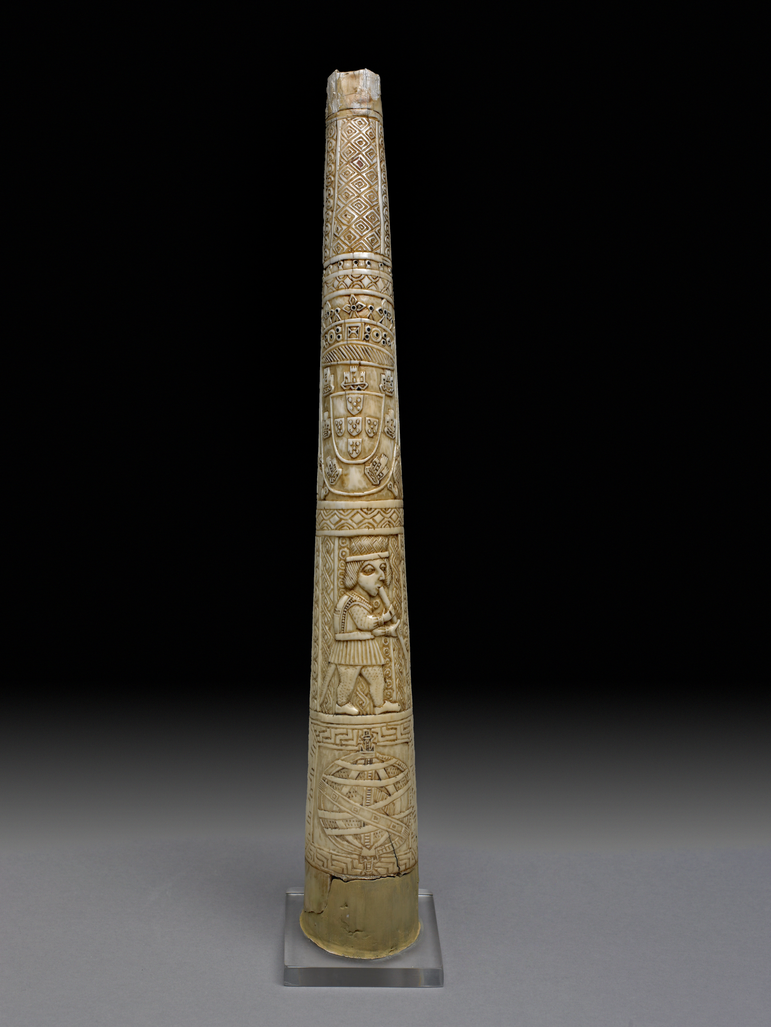
IMAGE 3: Oliphant (hunting horn), ca. 1525. Description: “Images highlighting the intertropical situation of Portugal’s empire were characteristic of Manueline architecture. An armillary sphere (bottom) and the coat of arms of the Portuguese House of Aviz (top) adorn an olifant made by craftsmen in Benin. Ivory objects like this horn from ca. 1525 were commissioned and purchased from West African artisans by Iberian travelers beginning in the late fifteenth century.” Description from Hugh Cagle, Assembling the Tropics (Cambridge University Press, 2018), p. 52. © The Trustees of the British Museum. Thank you to Prof. Cagle for providing this image.
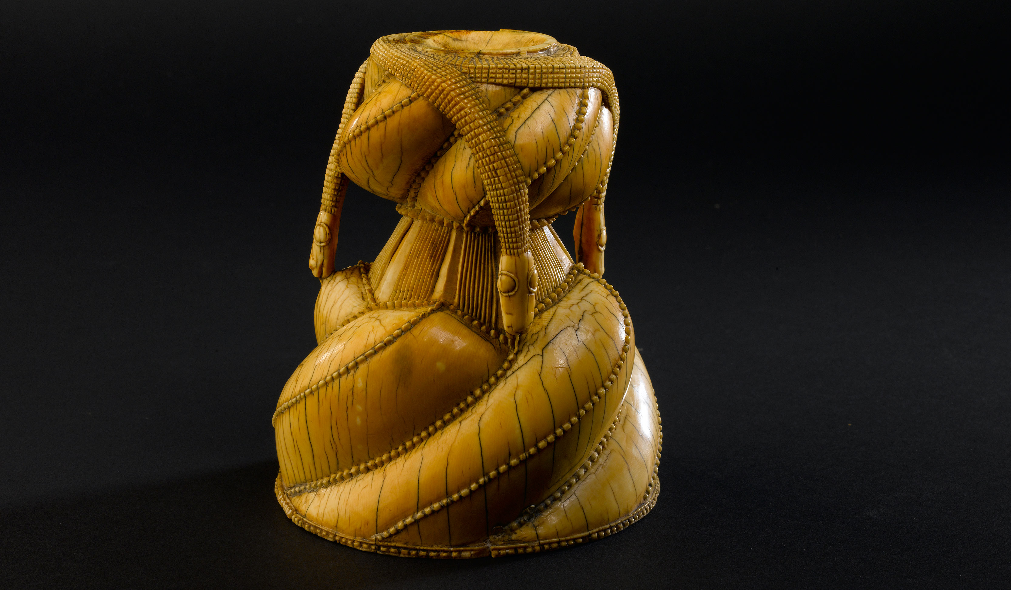
IMAGE 4: Ivory Salt Cellar Base, Sierra Leone, 16th c. Image downloaded from the Museu Nacional de Arte Antiga, Exposition: ‘A Cidade Global: Lisboa no Renascimento’. © Proprietário/Onshot, Rui Carvalho. Object description from The History Blog.
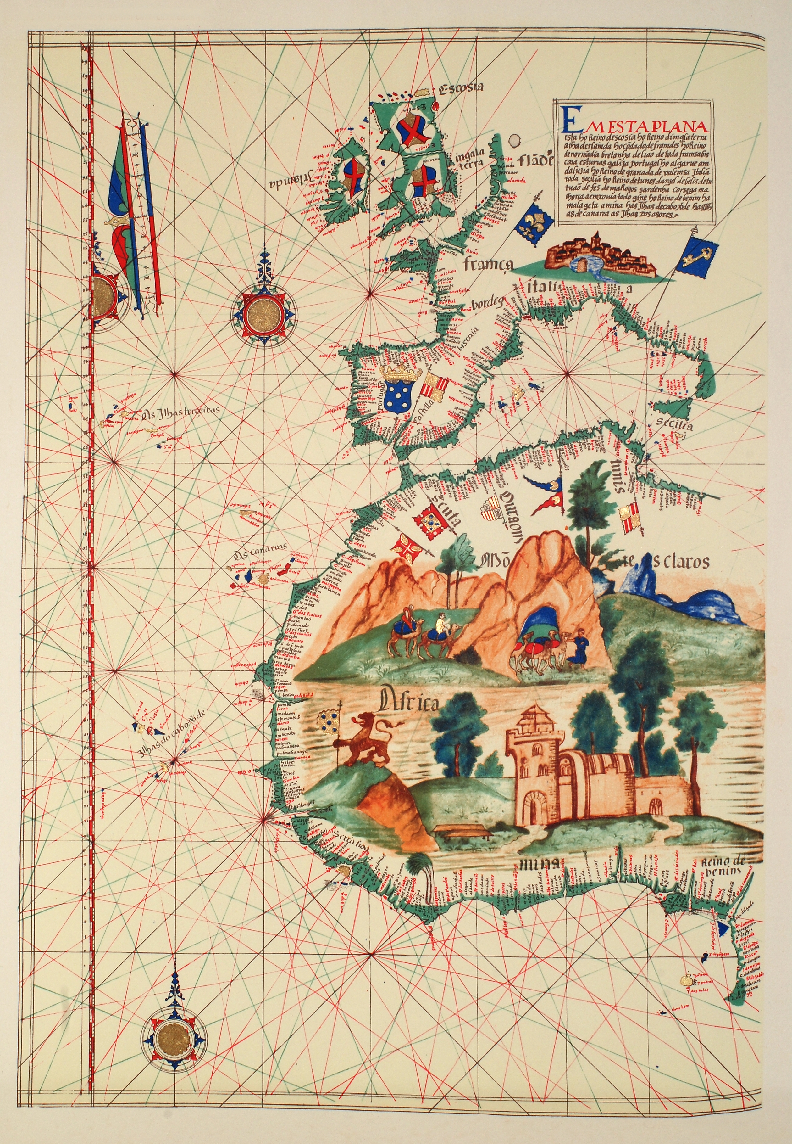
IMAGE 5: Nautical chart of Western Europe and West Africa, in the Atlas of Lázaro Luís, 1563. Creator: Lázaro Luís, Portuguese cartographer. Academia das Ciências, Lisboa. Downloaded from Wikimedia Commons. Public Domain. For a modern edition of the Atlas, see the Biblioteca Nacional de Portugal.
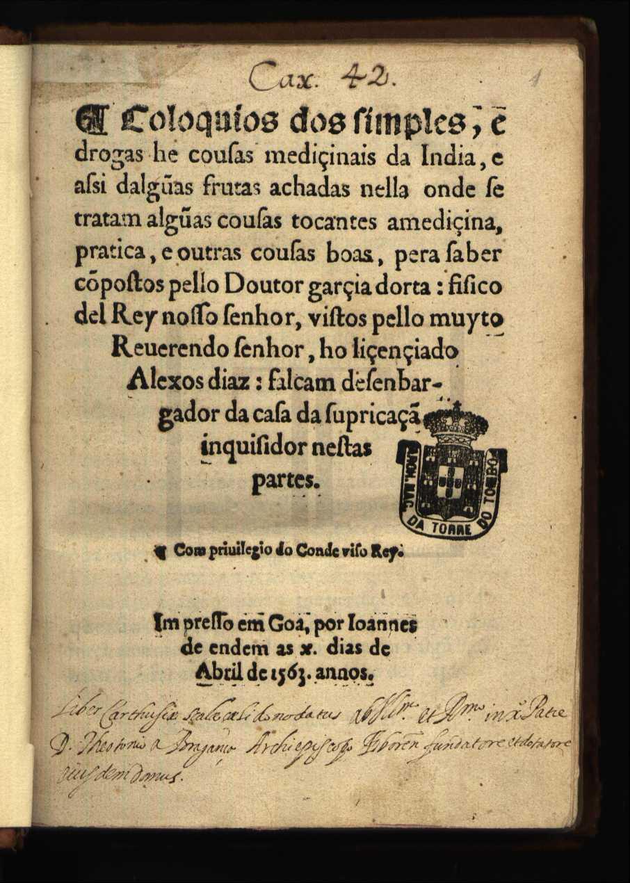
IMAGE 6: Title page, Garcia da Orta, Colóquios dos simples, e drogas he coisas mediçinais da Índia (Goa, 1563). Downloaded from the Archivo Nacional da Torre do Tombo. © 2008 – DGARQ – Direcção-Geral de Arquivos.
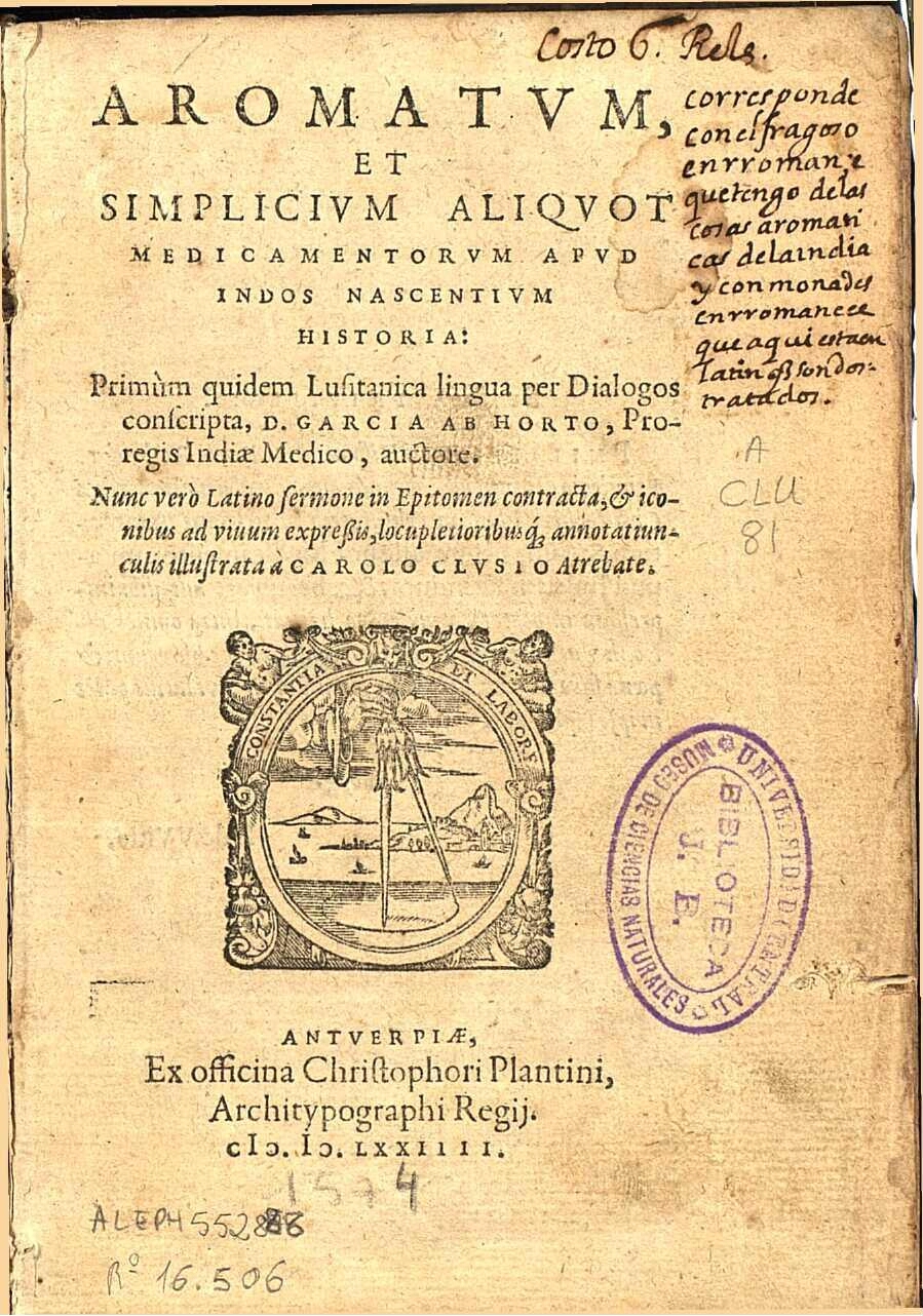
IMAGE 7: Title Page, Carolus Clusius, Aromatvm, et simplicivm aliqvot medicamentorvm apvd indos nascentivm historia: Primùm quidem Lusitanica lingua per Dialogos conscripta, / D. Garçia ab Horto, Proregis Indiae Medico, auctore. Nunc verò Latino sermone in Epitomen contracta, & iconibus ad viuum expressis, locupletioribusq[ue] annotatiunculis illustrata à Carolo Clvsio Atrebate (Antwerp, Ex officina Christophori Plantini, Architypographi Regii, 1574). Real Jardín Botánico, Madrid, Biblioteca Digital, A CLU 80.
IMAGE 8: Image of ‘TAMALAPATRA CVM SVO RAMVSCVLO’, in Carolus Clusius, Aromatvm, et simplicivm, fol. 80. Real Jardín Botánico, Madrid, Biblioteca Digital, A CLU 80. Thank you to Prof. Cagle for suggesting this image.
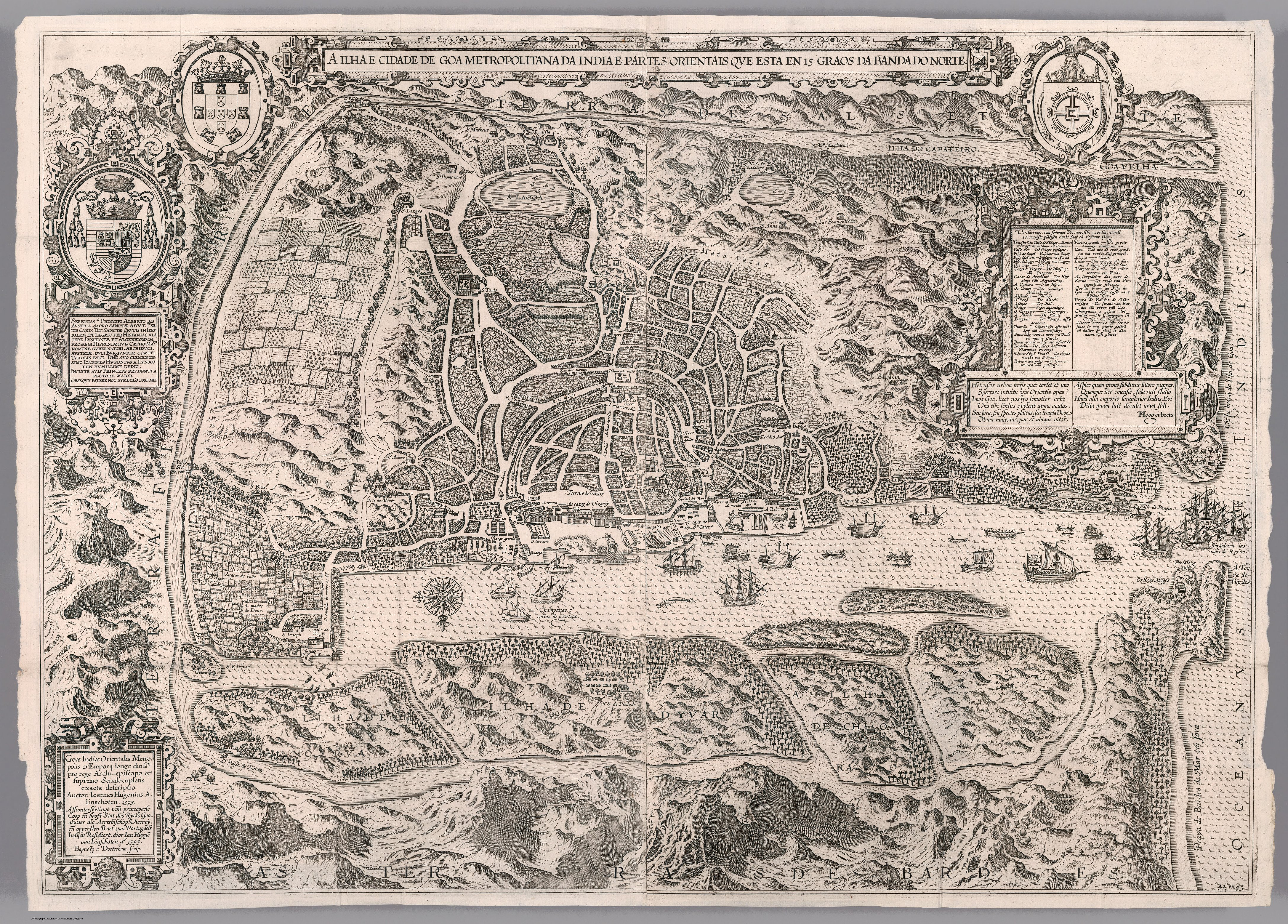
IMAGE 9: Jan Huygen van Linschoten, La Ville de Goa (‘A ilha e cidade de Goa metropolitana da India e partes Orientais qve esta en 15 graos da banda do norte’), 1595, in Jan Huygen van Linschoten and Bernard Paludanus, Histoire de la navigation de Jean Hugues de Linschot Hollandois, aux Indes Orientales (Amsterdam: Chez Evert Cloppenburgh, 1638), third edition, after page 54. Object Height: 60 cm, Object Width: 81 cm. Pub List Number: 12236.000. David Rumsey Historical Map Collection. © 2000 by Cartography Associates. Attribution-NonCommercial-ShareAlike 3.0 Unported (CC BY-NC-SA 3.0). Thank you to Prof. Cagle for suggesting this image.
IMAGE 10: Goa’s marketplace, in Jan Huygen van Linschoten, Histoire de la navigatione de Jan Huygen van Linschoten aux Indes Orientales (Amsterdam: Jan Evertz Cloppenburgh, 1619), second edition. Biblioteca Nacional de Portugal. Thank you to Prof. Cagle for providing this image.
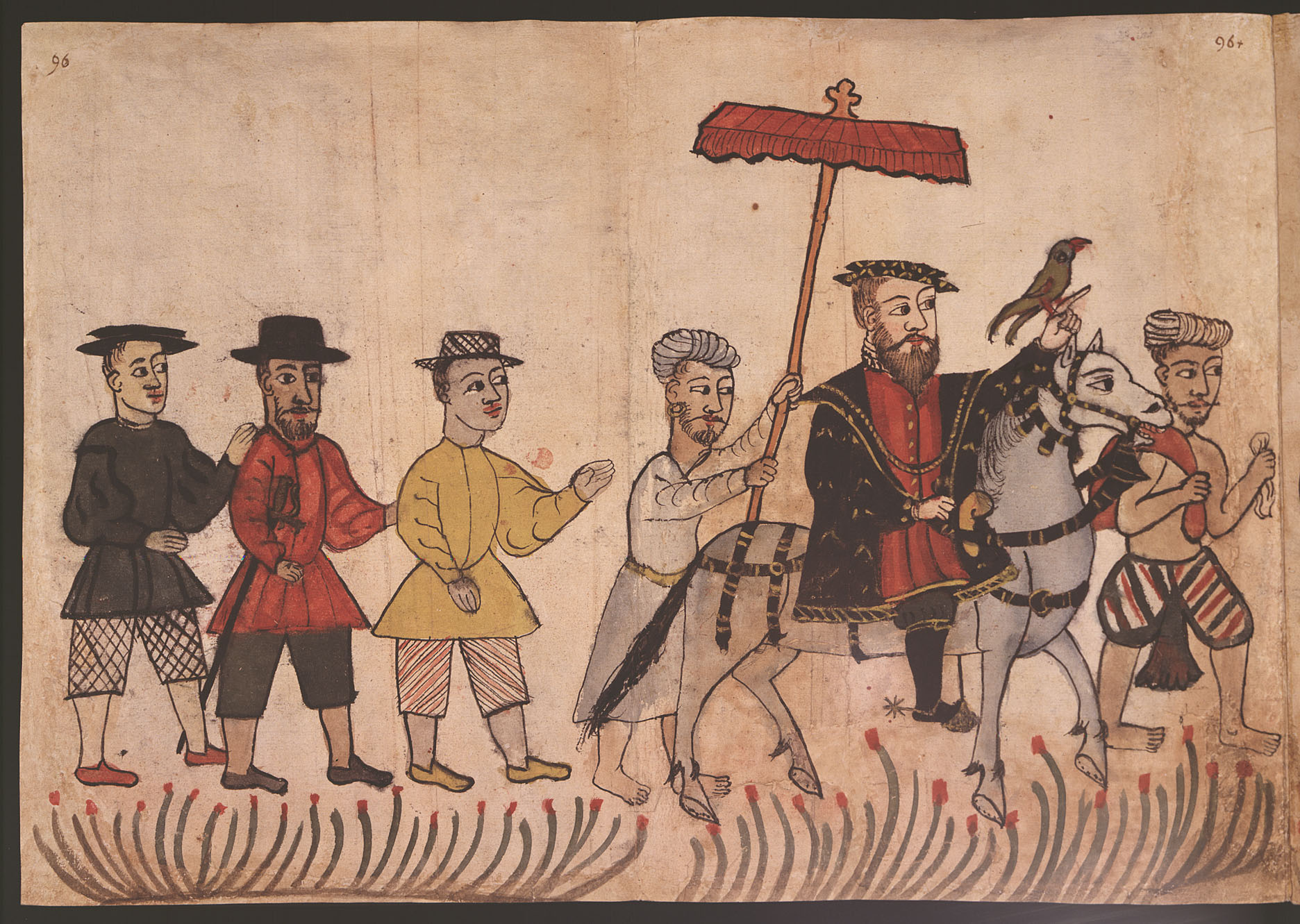
IMAGE 11: “Anonymous Portuguese watercolour illustration from the Códice Casanatense, depicting a Portuguese nobleman in India with his entourage.” Album di disegni, illustranti usi e costumi dei popoli d’Asia e d’Africa con brevi dichiarazioni in lingua portoghese, ca. 1540. Biblioteca Casanatense, Rome. Downloaded from Wikimedia Commons.
IMAGE 12: “An anonymous Portuguese watercolour illustration of an Hindu Brahmin goldsmith from Goa, from the 16th century Códice Casanatense. The inscription reads: ‘Brahmins of Goa, goldsmiths, gentiles'”. Album di disegni, illustranti usi e costumi dei popoli d’Asia e d’Africa con brevi dichiarazioni in lingua portoghese, ca. 1540. Biblioteca Casanatense, Rome. Downloaded from Wikimedia Commons.
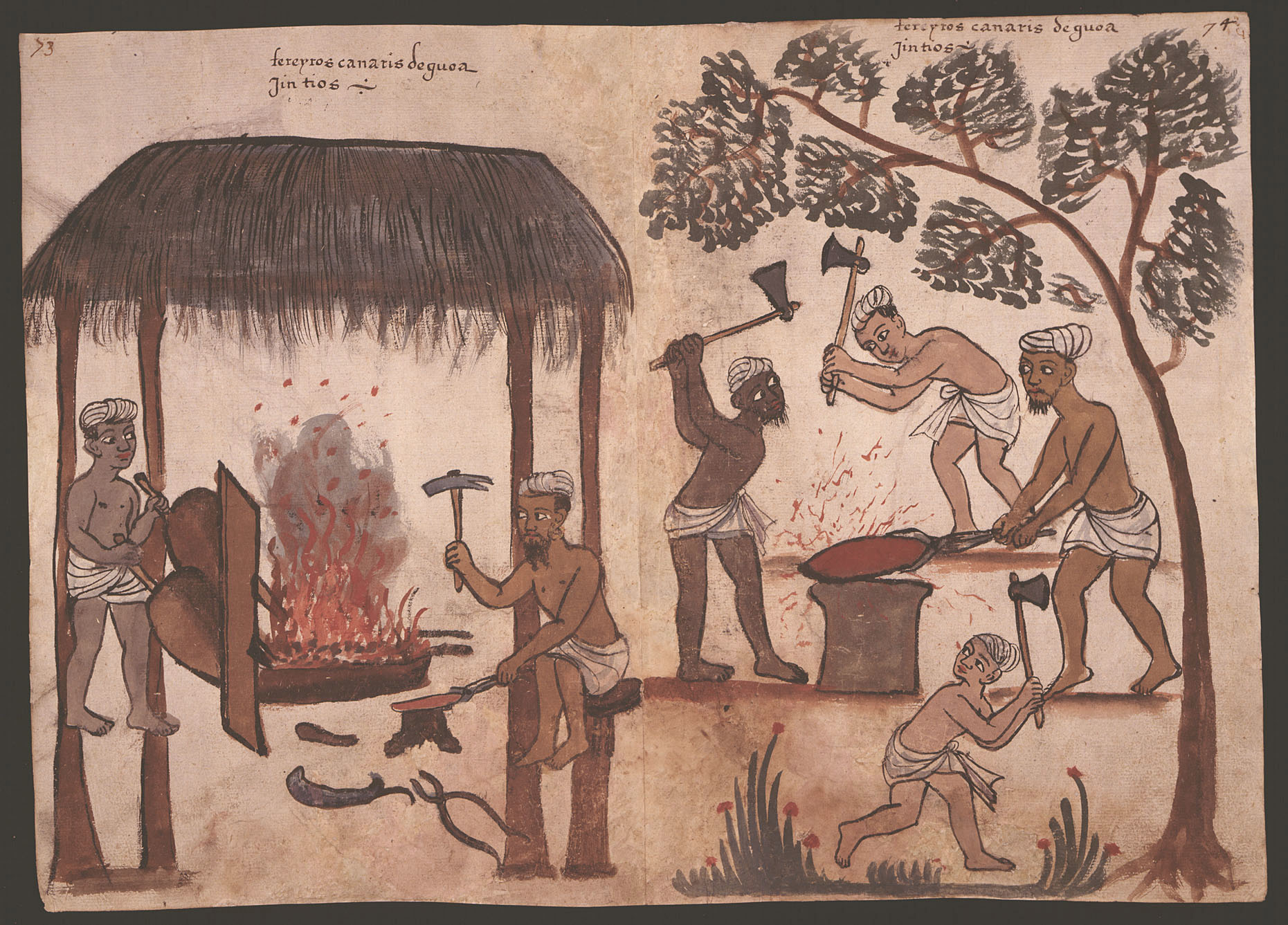
IMAGE 13: “Anonymous 16th century Portuguese illustration from the Códice Casanatense, depicting blacksmiths from Goa, in the Kanara Coast. The inscription reads: ‘Kanarese blacksmiths from Goa. Gentiles'”. Album di disegni, illustranti usi e costumi dei popoli d’Asia e d’Africa con brevi dichiarazioni in lingua portoghese, ca. 1540. Biblioteca Casanatense, Rome. Downloaded from Wikimedia Commons.
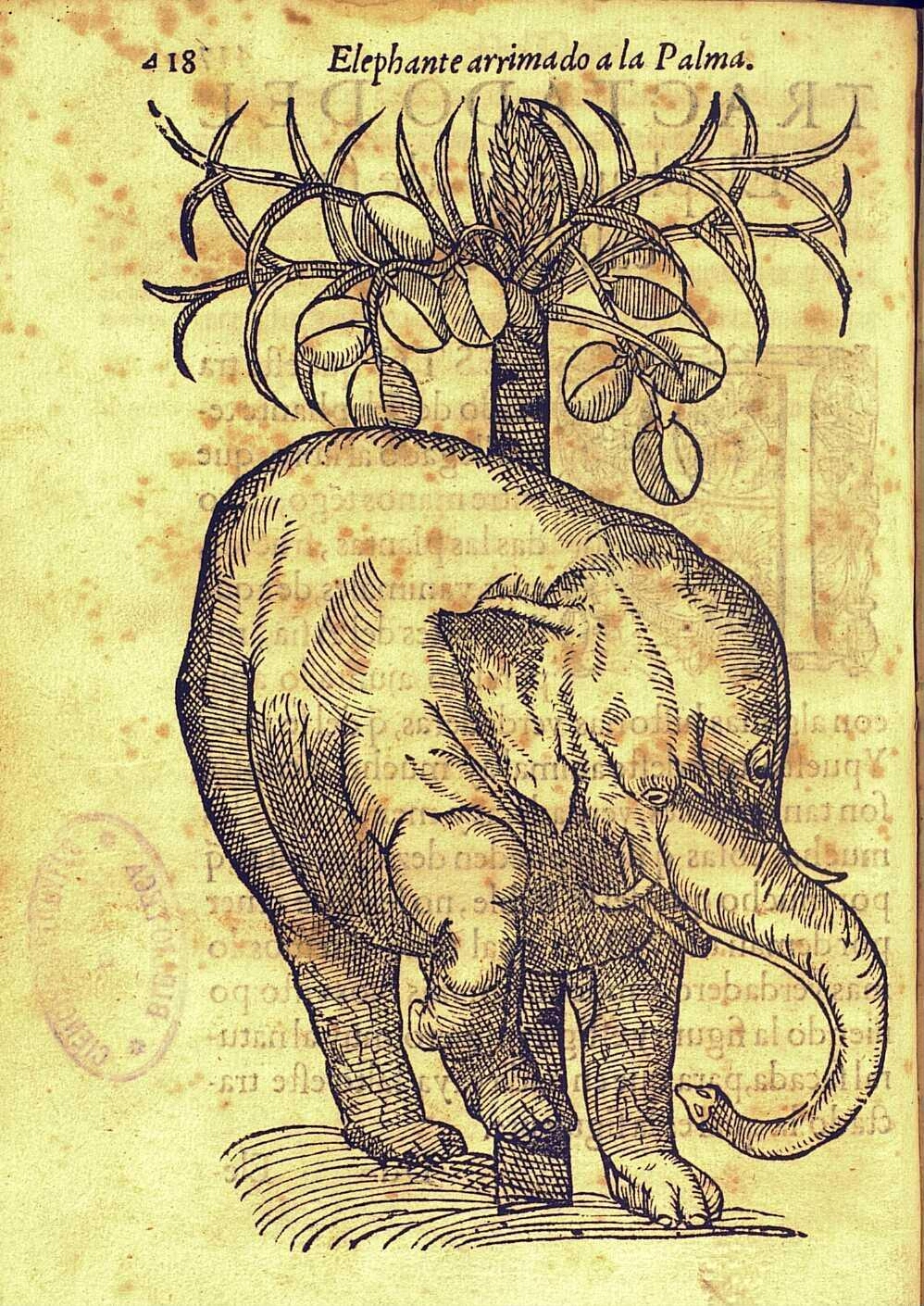
IMAGE 14: An elephant beneath a coconut palm, in Christovão da Costa, Tractado Delas drogas, y medicinas de las Indias Orientales, con sus Plantas debuxadas al biuo / por Christoual de Acosta medico y cirujano que las vio ocularmente. En el qual se verifica mucho de lo que escriuio el Doctor Garcia de Orta. Dirigido a la muy noble y más leal ciudad de Burgos cabeça de Castilla y camara de su Magestad (Burgos: Martín de Victoria, 1578), fol. 418. Real Jardín Botánico, Madrid, Biblioteca Digital, A ACO.
IMAGE 15: Northern Indian Ocean, in Atlas nautique du Monde, dit atlas Miller, 1519, fol. 3r. Notice n° : FRBNF40887480. Description from the World Digital Library: “The map presented here is from the Miller Atlas in the collections of the National Library of France. Produced for King Manuel I of Portugal in 1519 by cartographers Pedro Reinel, his son Jorge Reinel, and Lopo Homem and miniaturist António de Holanda, the atlas contains eight maps on six loose sheets, painted on both sides. The maps were richly decorated and illuminated by António de Holanda, a Dutch native who had been in Portugal for nearly ten years. The illustrations include ornate images of castles, towns, and architectural wonders; views of forests and other vegetation; and depictions of native peoples and animals. The shapes of some towns and coastlines are quite detailed. For other parts of the world about which Europeans still had limited knowledge, geographic details are drawn from the cartographer’s imagination or informed by views that originated with Ptolemy. One side of the map (folio 3 recto of the atlas) shows the Northern Indian Ocean with Arabia and India. The equator is shown; other features include the Red Sea, Gulf of Aden, Persian Gulf, Ganges Delta, and the Nicobar Islands. The reverse side (folio 3 verso) depicts the southern Indian Ocean with Insulindia (maritime Southeast Asia) on the left and Madagascar on the right. Both sides of the map have ornamental gold leaf, red banners with gold lettering for place-names, heraldic shields and flags, and vessels flying either the Portuguese Cross of the Order of Christ or the Ottoman crescent. The atlas takes its name from Emmanuel Miller, who purchased it in 1855 from a bookseller in Santarém, Portugal. Miller’s widow sold it to the National Library of France in 1897.” Bibliothèque nationale de France, downloaded from the World Digital Library.
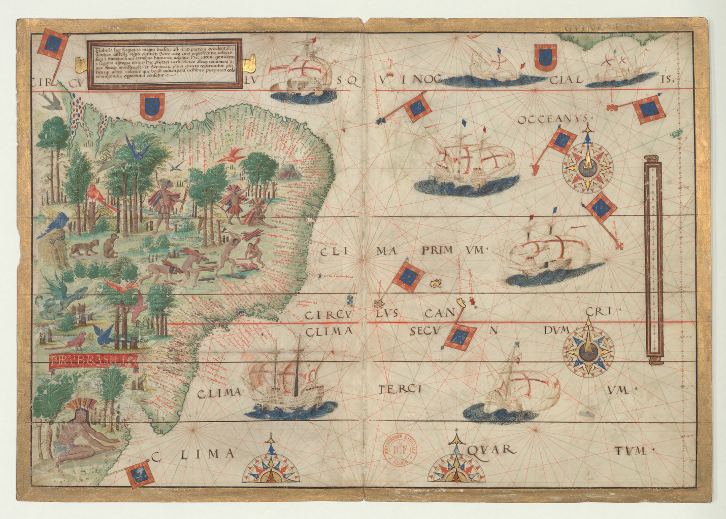
IMAGE 16: “Southwestern Atlantic Ocean with Brazil”, in Atlas nautique du Monde, dit atlas Miller, 1519, fol. 5r. Notice n° : FRBNF40887480. Description from the World Digital Library: “This map (folio 5 recto in the atlas) shows the southwestern Atlantic Ocean with Brazil; folio 5 verso is blank. The people of Brazil are shown as naked, or almost so, collecting wood or preparing for a hunt, and watched by exotic birds and beasts. A cartouche states that the Brazilians are ‘savage and very brutal.'” Bibliothèque nationale de France, downloaded from the World Digital Library.
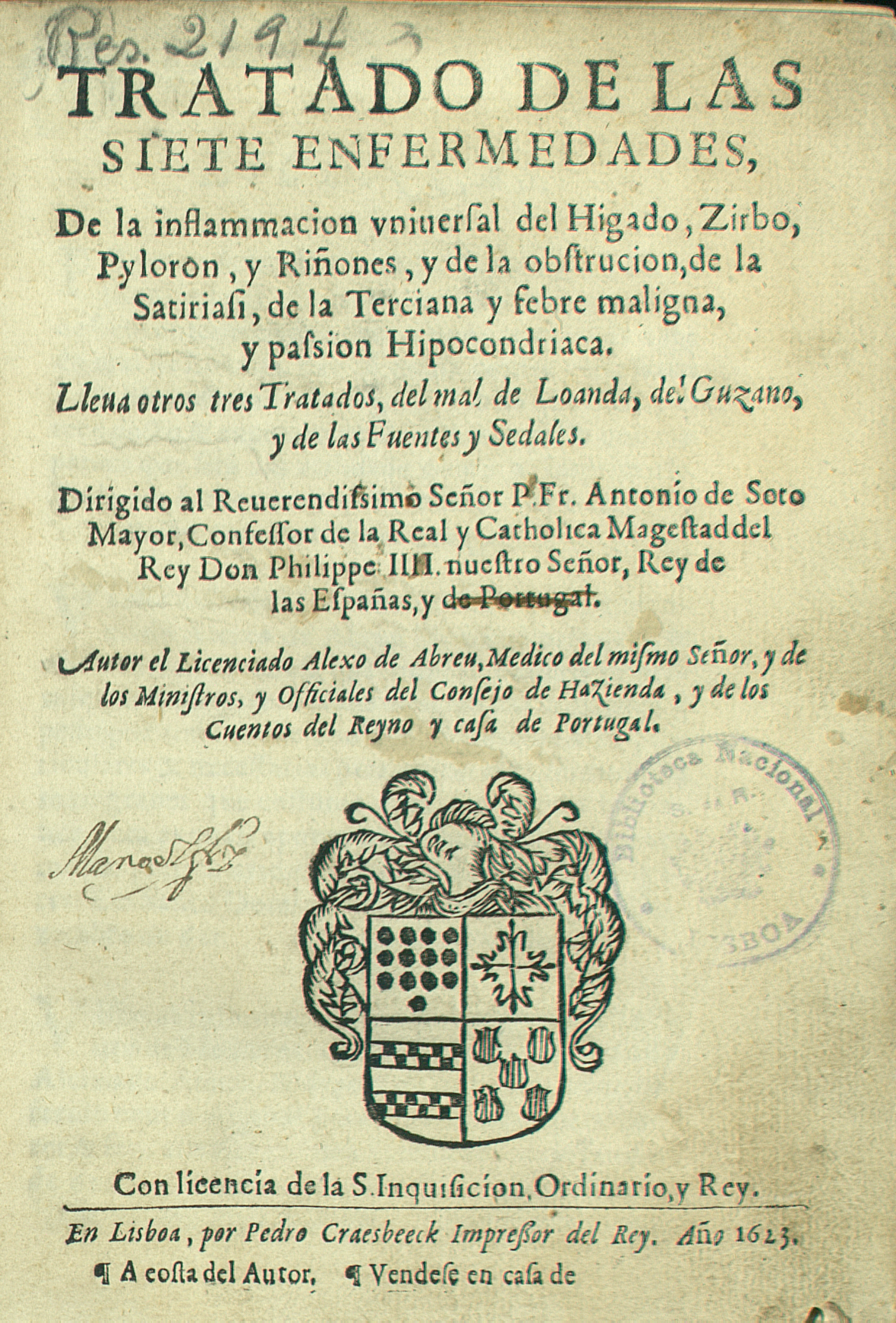
IMAGE 17: Title Page, Aleixo de Abreu, Tratado de las siete enfermedades (Lisbon: Pedro Craesbeeck, 1623). Biblioteca Nacional de Portugal. Thank you to Prof. Cagle for providing this image.
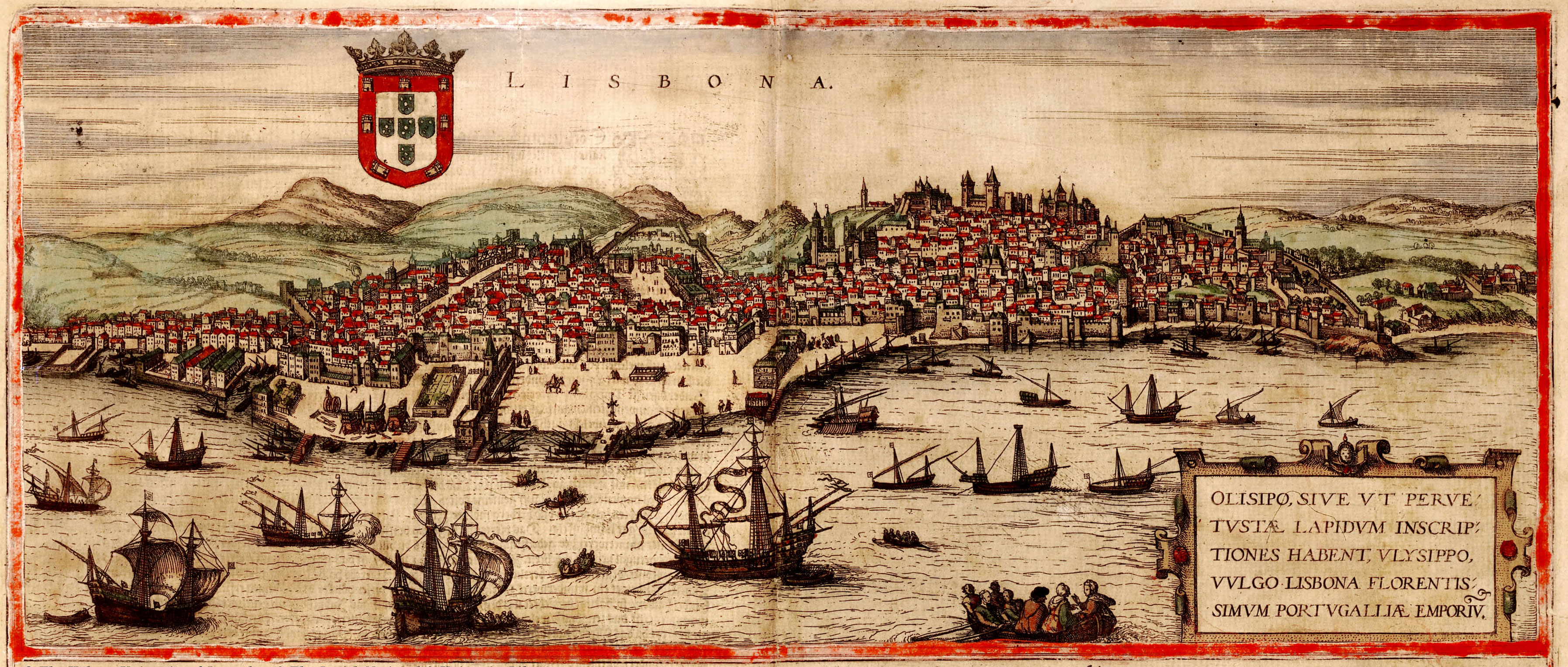
IMAGE 18: View of Lisbon, in Georg Braun and Frans Hogenberg, Civitates orbis terrarum (Cologne, 1572), vol. I. Downloaded from Wikimedia Commons. Public Domain.
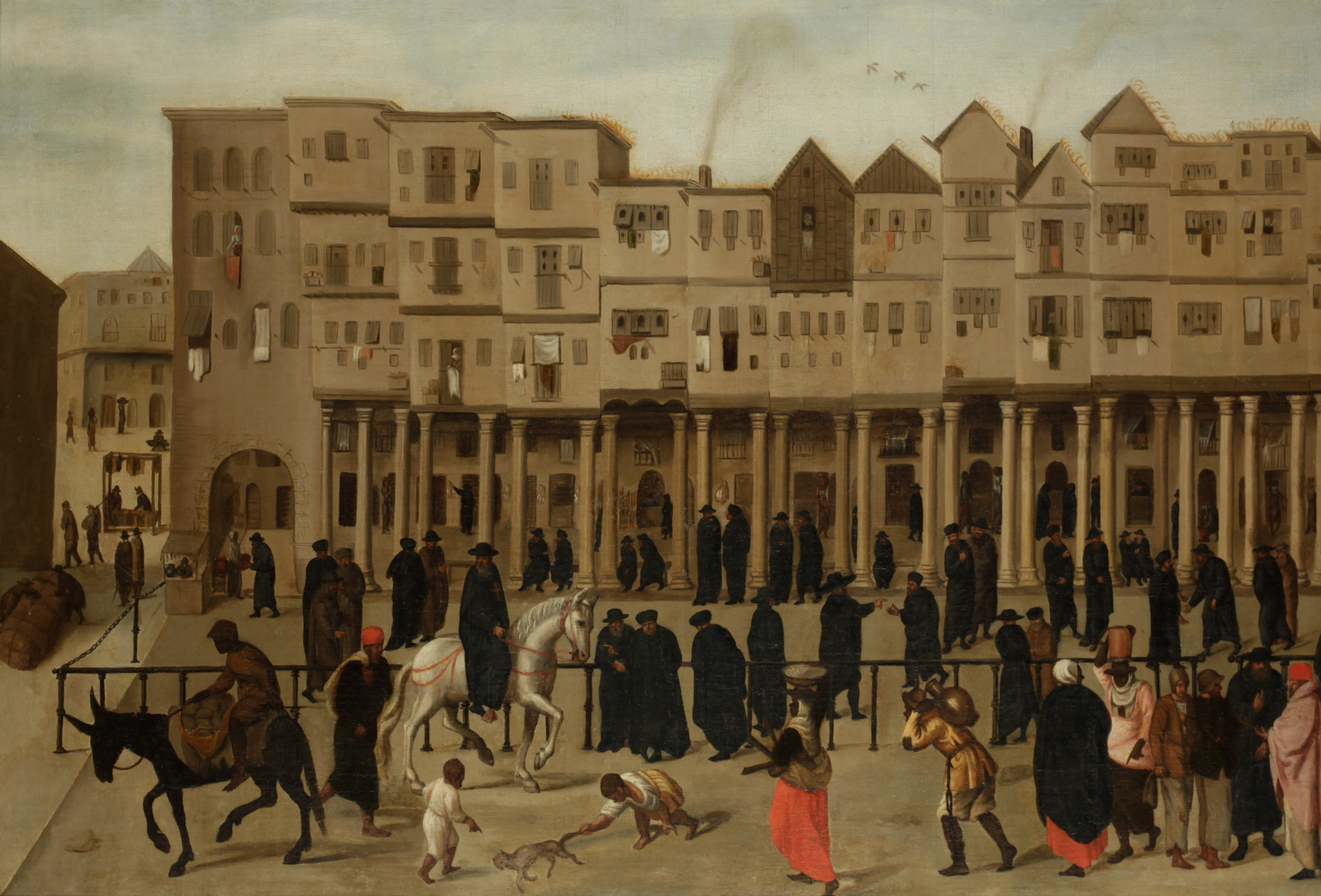
IMAGE 19: Anonymous, 16th c. “Painting depicting the Rua Nova dos Mercadores (lit. New Street of Merchants), the main commercial hub of 16th-century Lisbon, Portugal. The street was completely destroyed during the 1755 Lisbon Earthquake.” First part. Society of Antiquaries of London, Kelmscott Manor. Downloaded from Wikimedia Commons. Public Domain.
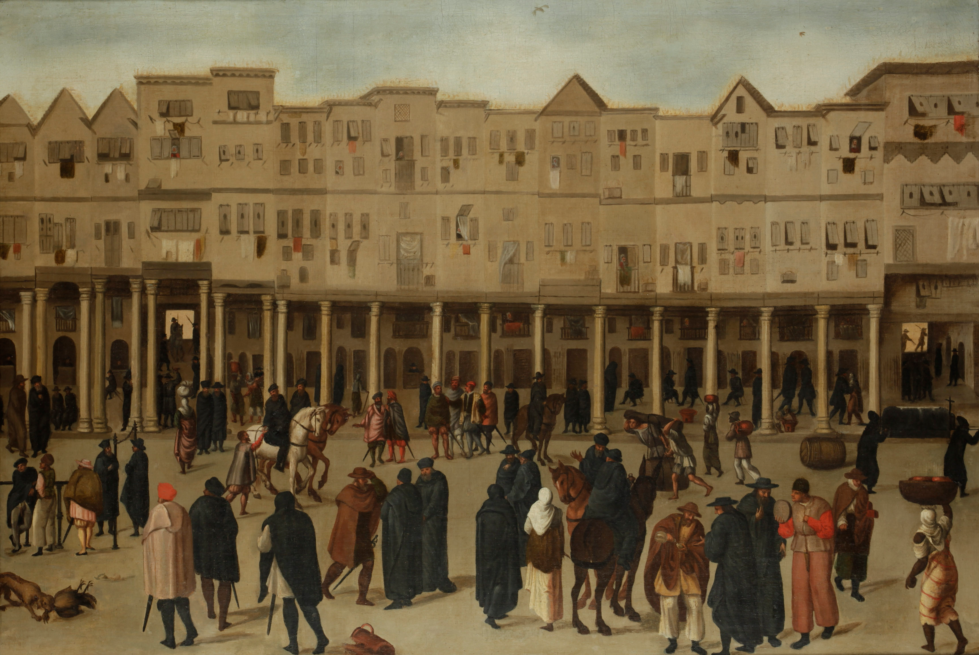
IMAGE 20: Anonymous, 16th c. “Painting depicting the Rua Nova dos Mercadores”. Second part. Society of Antiquaries of London, Kelmscott Manor. Downloaded from Wikimedia Commons. Public Domain.
